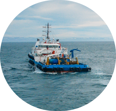
Track our Vessels

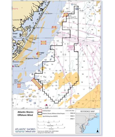
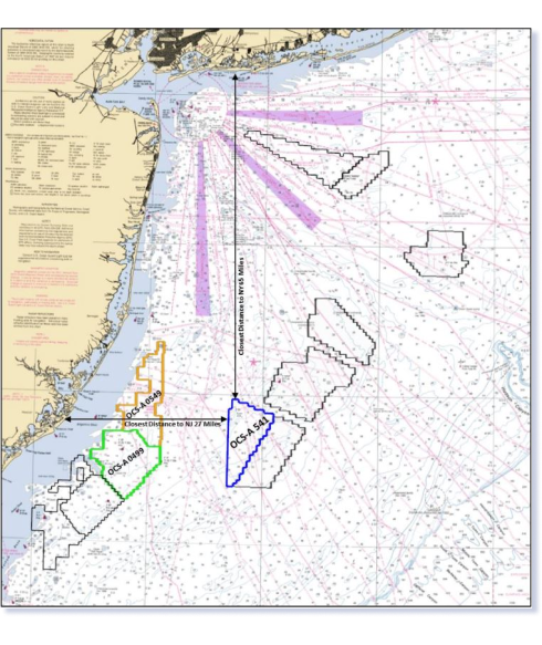
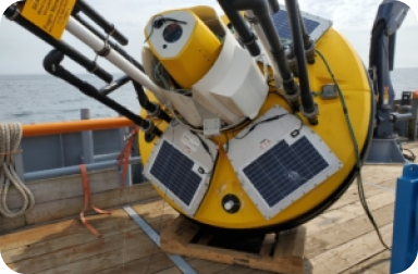
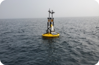
The Atlantic Shores geoscience team is conducting a multi-year investigation of seabed conditions in our lease areas and cable corridors to support project engineering.

Geoscience, which includes geophysical and geotechnical- or G&G, combines both science and engineering. Atlantic Shores’ G&G campaign works to create a map of the seabed in order to better understand the environment in which turbines will be constructed. This work is integral to designing the front end engineering aspects of an offshore wind project and is necessary for meeting both permitting and regulatory requirements.

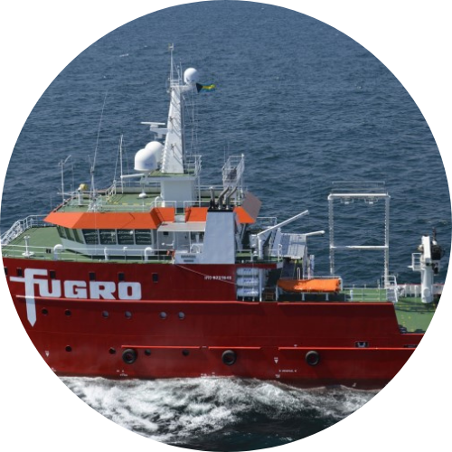
More than 85 United States based personnel and 6 US survey vessels are engaged in the campaign, including 3 New Jersey-owned and operated vessels.

GPS Coordinates for Lease Area Boundaries

Lease Area 0499

39.13976193-74.09576420
39.26254699-73.94436674
39.32158277-73.94269476
39.32278181-73.99698492
39.37124038-74.04571642
39.37072214-74.19149985
39.30795700-74.19104773
39.30627164-74.24843634
39.27574837-74.24867309
39.27500009-74.22664858
39.24260937-74.19366915
39.21613229-74.19196190
39.13976193-74.09576420

Lease Area 0549

39.32220694-73.94197663
39.67574952-73.93837968
39.57842437-74.05187770
39.54563139-74.04886232
39.52971889-73.99464029
39.45700366-74.10570067
39.37127270-74.10779465
39.37071064-74.04569840
39.32338181-73.99612002
39.32220694-73.94197663

Lease Area 0541

39.47995625-73.63214275
39.45346416-73.63315032
39.45363171-73.64717070
39.19437014-73.65203542
39.19401612-73.62441085
39.42591382-73.44600466
39.47995625-73.63214275

Buoy data supports research and is shared with mariners

Our survey activities are critical in understanding the seabed conditions within Atlantic Shores’ Lease Areas.

We deployed four metocean buoys near Lease Area 0499 to gather ocean and air observations. The data collected by the buoys helps us to measure wind, ocean and weather conditions in order to inform the best development strategy for turbines. The data also contributes to the ongoing research, monitoring, modeling and analysis efforts of US governmental and academic institutions in the Mid-Atlantic region.

As part of our efforts we are proud to partner with MARACOOS to publicly release the data from all the buoys by using their web platform.

*Photos courtesy of Fugro

Fisheries communication plan

Atlantic Shores Offshore Wind is actively working with the fishing community – both commercial and recreational – to understand their concerns and create a development plan with as little impact on fishing as possible. Our team aims to find a balance in the shared use of our ocean by seeking to understand and mitigate any potential effects our activities may have on the environment, wildlife, and industries that fuel our local economies. Our fisheries communication plan outlines ways fishermen can communicate concerns to our development team and methods Atlantic Shores will utilize to keep the fishermen informed and educated about our projects.

Fisheries Communications Plan – Lease Area OCS-A 0499

Fisheries Communications Plan – Lease Area OCS-A 0541

survey vessel
operations signup

By filling out the information below you will receive email updates about survey vessel operations taking place in the Atlantic Shores Lease Areas. We will be providing many different pieces of information within our bulletins, including:

  • Lease Area locations (including maps)
  • Survey vessel descriptions (project details, vessel information, contact information, location, etc.)
  • Other miscellaneous updates & more!

Gear Loss Reimbursement Form

Atlantic Shores and our contractors will make every attempt to avoid damaging fishing gear in our lease area during surveys, construction, and operations. If a fisherman experiences gear loss or damage that they believe was caused by or the result of Atlantic Shores’ activities, they should complete our Gear Loss Reimbursement Form.

Download the Form Here

We look forward to connecting with you.

Name
Address